

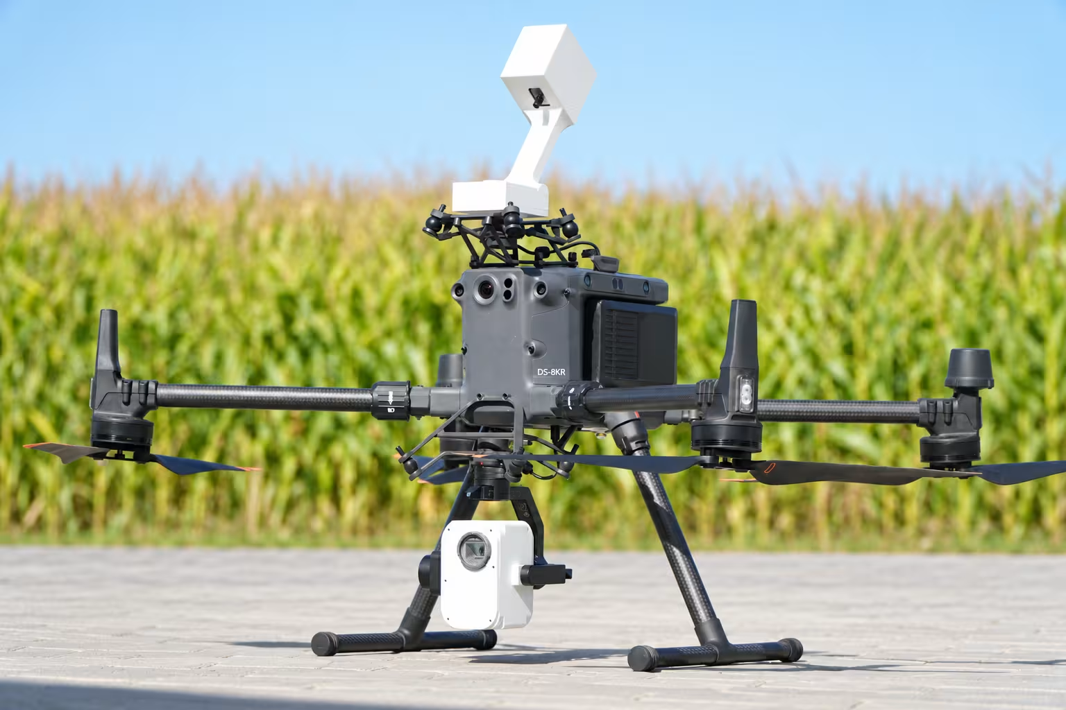
Spectral resolution
A spectral sensor, sky-reference unit and field-to-map software workflow for agricultural and environmental research.
300 RTK / 350 RTK / 400
One system for
spectral field measurements.
The airborne sensor records spectral information. Continuous sky-reference measurements support correction for changing light. Field and desktop software connect acquisition to mapped output.
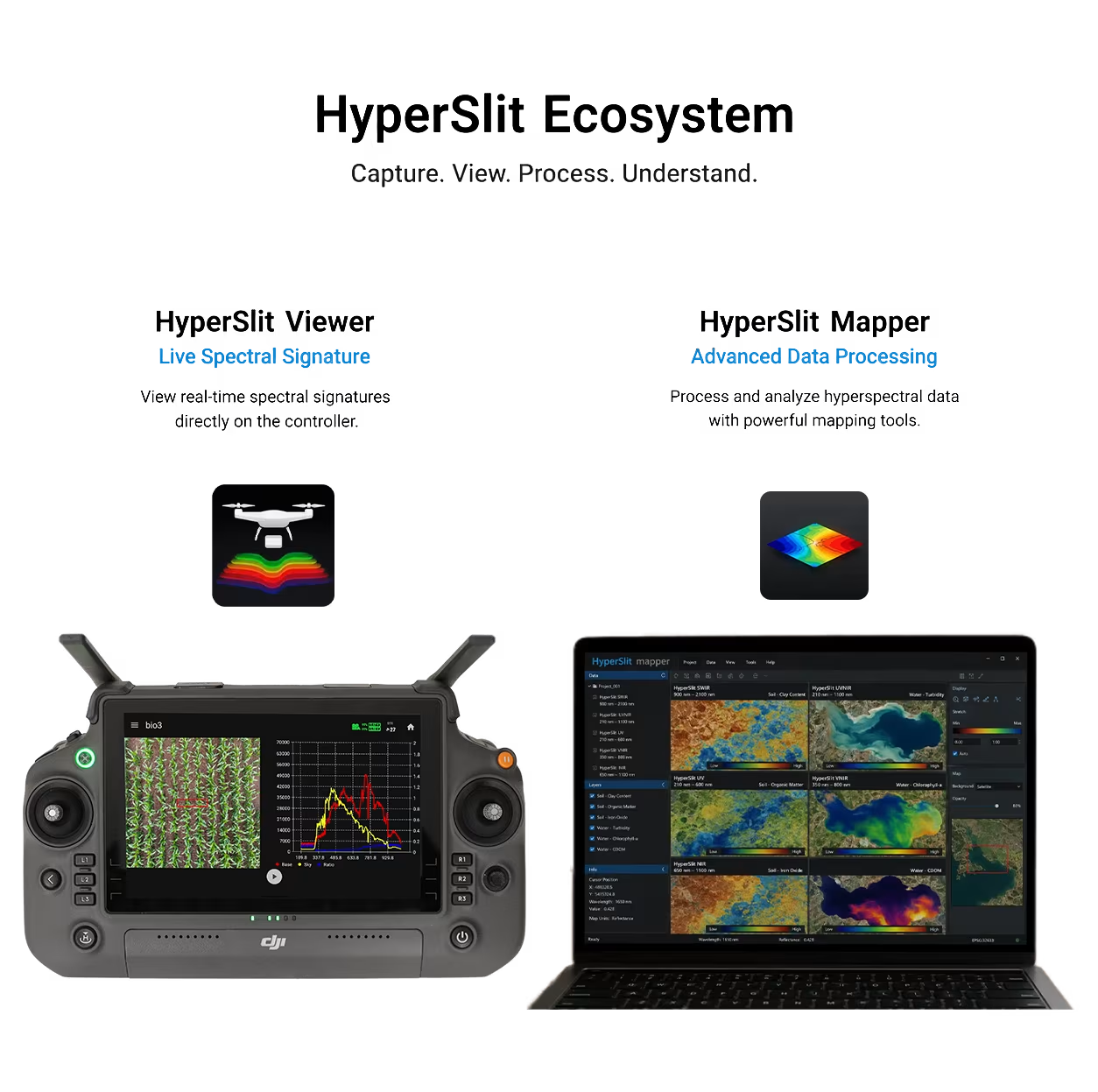
Sky unit
Captures continuous white-reference measurements during flight. Monitor sky ratio and adjust sky and ground integration times as conditions require.
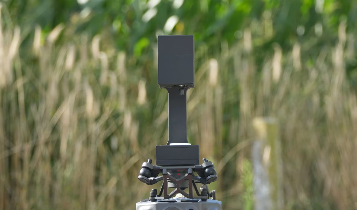
HyperSlit Viewer
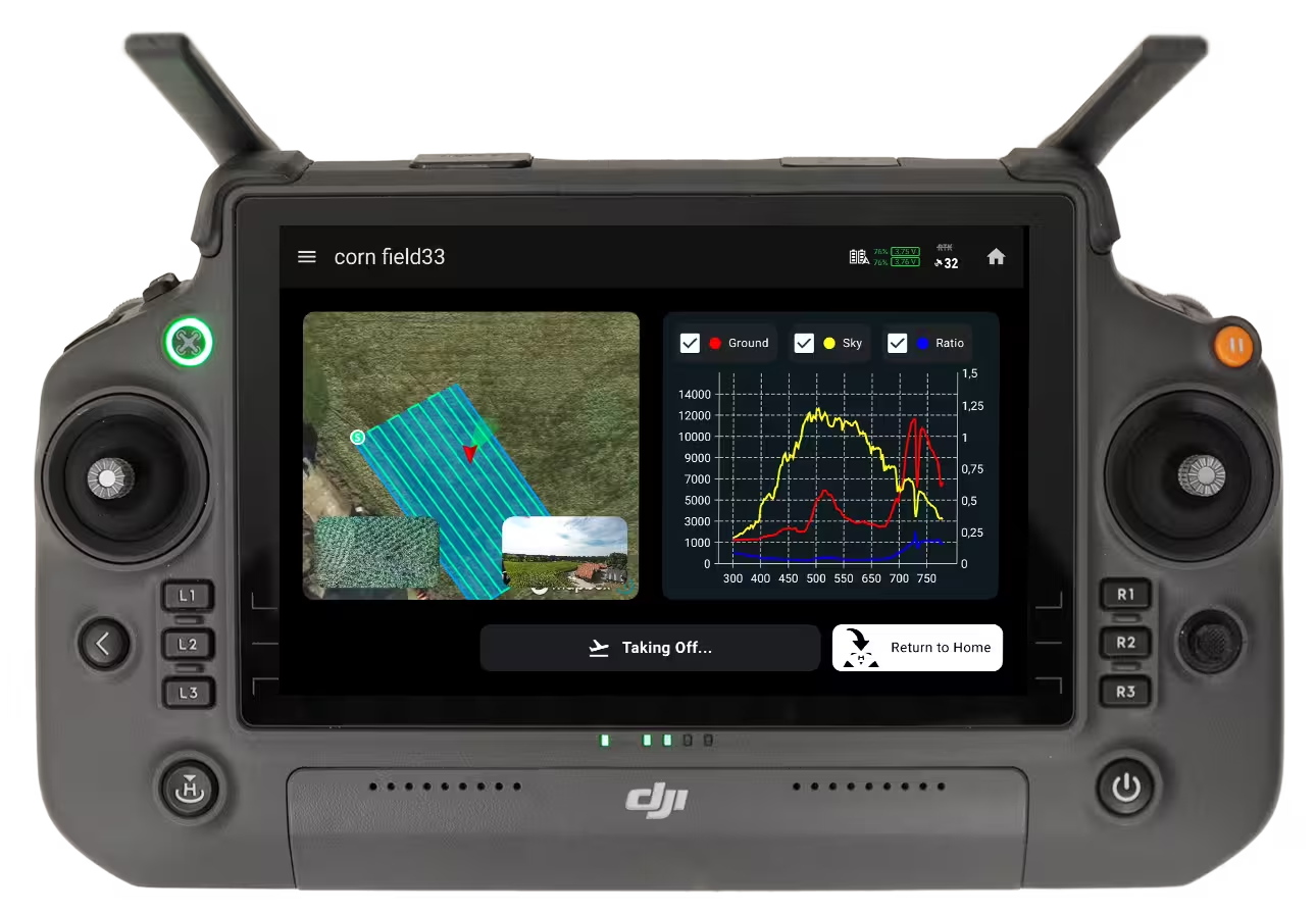
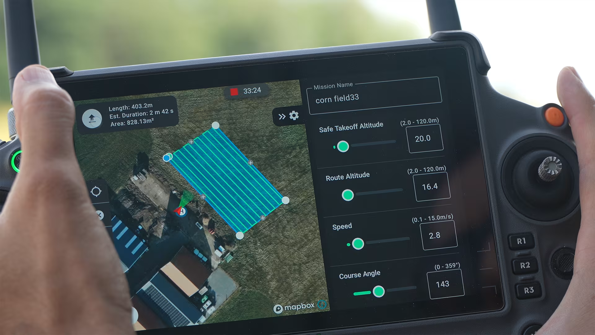
Prepare area-scan missions on the controller and watch the spectral signature live during acquisition.
HyperSlit Mapper

Process captured missions into spectral maps and export interpolated GeoTIFF files for further analysis.
HyperSlit Viewer.
See the application in use.
Prepare the mission, follow live spectral measurements and review the acquisition from the controller.
Plan the survey
on the controller.
Create area-scan missions and prepare the capture route for the field you want to measure.
Choose the range
for your measurement.
Four models cover different parts of the spectrum. Match the wavelength range to the surface and the research question.
UV210–600 nm
Ultraviolet and visible spectral behaviour.
VIS350–800 nm
Visible-light surface and vegetation analysis.
NIR650–1100 nm
Near-infrared reflectance investigation.
SWIR900–2100 nm
Short-wave infrared material and moisture-related variation.
System
specifications.
Plan your aircraft configuration and acquisition workflow with the technical details in view.
Download the full datasheet| Specification | Detail |
|---|---|
| Spectral resolution | 0.5 nm |
| Dynamic range | 4600:1 |
| Signal-to-noise ratio | >1500:1 |
| Compatible aircraft | DJI Matrice 300 RTK, 350 RTK and 400 |
| Positioning | GPS data directly from the drone |
| Visual reference | Co-axial RGB camera with geotagged images |
| On-board storage | MicroSD card |
| Controllable gimbal | Yaw −320° to +320° · pitch −120° to +30° |
| Mapped output | Interpolated GeoTIFF export from HyperSlit Mapper |
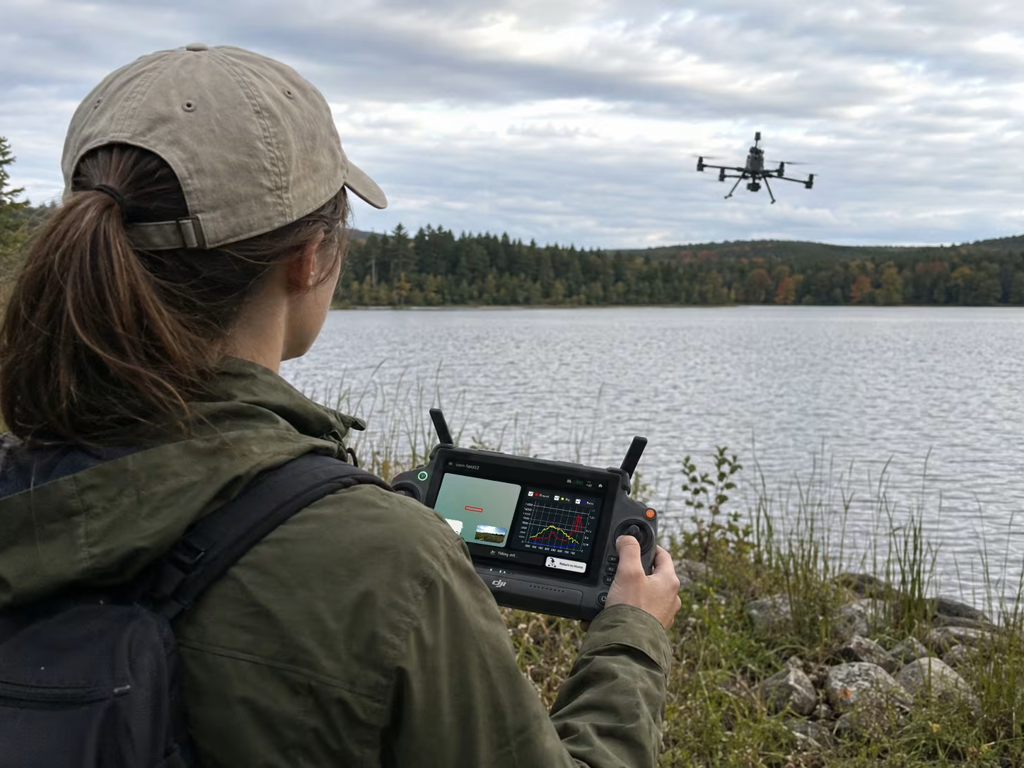
Vegetation. Soil.
Water. Materials.
Investigate spatial variation across your selected wavelength range. Use a suitable survey design and field validation method to interpret the spectral differences for your research question.
Hyperspectral mapping applicationsStart with the measurement.
Tell us about the surface, wavelength range, area and outputs your research needs.